REVIEW · CHARLESTON
Charleston Self-Guided Audio Walking Tour
Book on Viator →Operated by Adventures with Action · Bookable on Viator
Charleston has a way of looking sweet and feeling sharp. This self-guided audio walking tour turns famous spots like Rainbow Row into a story you can follow on foot. I like the hands-free GPS narration that plays when you reach each stop, and I also like the lifetime access so you can reuse it on return trips. One heads-up: a few parts of the route can feel light on audio or directions if your phone loses the GPS trigger, so staying on the planned path matters.
You walk about 2+ miles and the audio is built for roughly 1–2 hours, though you’ll naturally stretch it to 1–3 hours if you stop for photos, snacks, and museum time. The route is full-year, English-only, and set up for offline listening after you download it once. If you hate walking through any kind of city block-to-block stretches, you’ll want to pace yourself and plan breaks.
In This Review
- Key points before you start
- A self-guided Charleston walk that guides your feet
- Getting the app working: password, offline download, and GPS tips
- Circular Congregational Church and Hibernian Hall: early Charleston in one block
- Circular Congregational Church (Stop 1)
- Hibernian Hall (Stop 2)
- South Carolina Historical Society Museum and the Four Corners of Law
- South Carolina Historical Society Museum (Stop 3)
- Four Corners of Law (Stop 4)
- South Carolina Society Hall (Stop 5)
- John Robert Pringle House, Patrick O’Donnell House, and life in the streets
- John Robert Pringle House (Stop 6)
- Patrick O’Donnell House (near Miles Brewton House, unlabeled stop)
- White Point Garden, Civil War stakes, and General William Moultrie
- White Point Garden (unlabeled stop)
- Charleston in the Civil War (unlabeled stop)
- General William Moultrie monument (unlabeled stop)
- Palmer Home and Edmondston-Alston House: old homes with political ties
- Palmer Home (Stop 7)
- Edmondston-Alston House (unlabeled stop)
- Longitude Lane and Longitude’s “real” cannon story
- Longitude Lane (Stop 8)
- Rainbow Row: mercantile beginnings and what you should look for
- Rainbow Row (Stop 9)
- Slave Auction Site Memorial and Old Slave Mart Museum: the hard part of the walk
- Slave Auction Site Memorial (Stop 10)
- Pineapple Fountain (Stop 11)
- Old Slave Mart Museum (Stop 12)
- Dock Street Theater, St. Philip’s Church, and the bend in the street
- Dock Street Theater (Stop 13)
- St. Philip’s Church (Stop 14)
- Ending at Charleston City Market: crafts, food, and a natural finish
- Charleston City Market (Stop 15)
- How much time you’ll need (and when the walk gets awkward)
- Is this Charleston Self-Guided Audio Walking Tour worth booking?
- FAQ
- How long is the Charleston self-guided audio walking tour?
- Is the tour available only once, or can I use it on future trips?
- Do I need Wi‑Fi during the walk?
- What language is the narration offered in?
- Where does the tour start and end?
- Do I need tickets or reservations for the stops?
- How do I start the tour once I’m at the location?
- Can two people share the same tour?
Key points before you start
- Lifetime, no-expiry access means you can listen now or bring it back on another Charleston trip.
- Offline GPS audio works without cellular or Wi‑Fi after the initial download.
- 45+ audio stories at specific sites, with optional extra material in the app.
- Outdoor and ticket-free-feeling stops keep the cost down while still covering big names and big events.
- Flexible pacing lets you pause anytime, detour, then jump back in when you’re ready.
A self-guided Charleston walk that guides your feet

This is not one of those sit-and-listen tours where you’re stuck behind someone else. The whole idea is simple: you download the app, get a password, then the audio starts based on your location as you follow the route. You still control the pace, so you can stop for a photo, duck into a museum if it’s open, or just take a breath when the sun or the crowds get too much.
The tour starts at 152 Market St and finishes at Charleston City Market at 188 Meeting St. No staff meet you at the beginning, so you’re responsible for getting to the start point and then triggering the first story where the app cues it. That freedom is a plus, but it also means you should pay attention early on and make sure your phone is behaving.
For a walking tour, I strongly recommend headphones/earbuds. The audio is designed to play automatically, and using your own earbuds keeps things clear when you’re near street noise.
Other walking tours we've reviewed in Charleston


Getting the app working: password, offline download, and GPS tips
Plan for one small tech step before you go. After booking, you’ll receive email/text instructions with a password, and you’ll need to download the Action’s Tour Guide App while you have solid Wi‑Fi/cellular. Once it’s downloaded, the experience is designed to work offline, with no need for constant service while you walk.
Phone behavior matters. Keep your phone from going into sleep mode so the GPS stays active and the audio triggers on time. If you start wandering too far from the path, the tour can pause audio and force you to catch up—so treat the route like rails, even though you can still pause whenever you want.
One more practical detail: device compatibility is part of the setup. The recommended baseline is iPhone iOS 15+, Android 9+, or an iPad/tablet with GPS and cellular connectivity. If you’ve got an older device, I’d expect a higher chance of GPS quirks.
Circular Congregational Church and Hibernian Hall: early Charleston in one block

Circular Congregational Church (Stop 1)
This is one of the best “start right” places in Charleston. The congregation traces back to 1681, originally known as the White Meeting House for dissenters who didn’t conform to the Church of England. The current circular building dates to 1891 after the earlier structure was destroyed by fire.
What I like here is how the audio frames religion as community infrastructure, not just a building. You get a sense of why these early meeting places mattered, and the circular architecture makes it easy to orient yourself while listening.
Hibernian Hall (Stop 2)
A short hop brings you to Hibernian Hall, built in 1840 and connected to the Hibernian Society of Charleston. The society was founded in 1801 by Irish immigrants and their descendants to provide aid, support, and cultural activities.
This stop adds an angle Charleston visitors sometimes miss: immigration as a network of help and identity. If you want the city’s history to feel lived-in, this is a solid story beat.
Other guided tours in Charleston


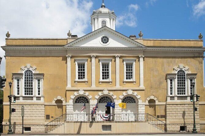
South Carolina Historical Society Museum and the Four Corners of Law

South Carolina Historical Society Museum (Stop 3)
The South Carolina Historical Society (SCHS) was founded in 1855, and the museum is its main public face. The app uses this point to give context about what the organization preserves and why it exists.
Even if you don’t go inside, it works as a “reset” stop in the tour. You’re moving from religious and community stories into governance and records—perfect timing.
Four Corners of Law (Stop 4)
At the intersection of Broad and Meeting Streets, you’ll hear the meaning behind the name: four significant buildings that represent different legal and government functions converge here. The point of the story isn’t just branding. It shows how downtown space concentrates power.
If you like “how cities work,” this is where you start seeing Charleston as a machine built to run courts, rules, and commerce.
South Carolina Society Hall (Stop 5)
South Carolina Society Hall was built in 1803 and is also tied to the South Carolina Society for the Preservation of Spirituals. It began as a commission for the South Carolina Society, a social and charitable group founded in 1737.
This stop can hit in two ways: the architecture gives you something physical to look at, while the story points to culture and organization working together. You’ll likely glance at the details longer than you planned.
John Robert Pringle House, Patrick O’Donnell House, and life in the streets

John Robert Pringle House (Stop 6)
The audio here shifts from big institutions to personal life. The John Robert Pringle House story is framed as an example of what European colonist life could look like in early Charleston.
It’s a good counterweight after the civic and community stops. The tour gives you a human scale moment: rules and organizations are one thing; daily life is another.
Patrick O’Donnell House (near Miles Brewton House, unlabeled stop)
Two houses down from the Miles Brewton House, you’ll hear about the Patrick O’Donnell House. The story goes that O’Donnell wanted the house to be perfect for his fiancée, so construction took 12 years.
This is a romantic detail, but it also signals wealth, time, and what people expected their homes to do for status. When the audio mentions the long build, look at the house and ask yourself what “worth waiting for” meant then.
White Point Garden, Civil War stakes, and General William Moultrie
White Point Garden (unlabeled stop)
This park started as Oyster Point and served as a gathering place as early as the 18th century. It also played roles in defense and major events during Charleston’s history.
This stop matters because it changes your tempo. After clusters of buildings, you get open space and a different kind of soundscape, which makes the narration feel more dramatic rather than informational.
Charleston in the Civil War (unlabeled stop)
The tour then connects Charleston’s geography to outcomes. It calls out the city’s strategic value: a deepwater port and a major cotton production and export center. The narration emphasizes why controlling Charleston mattered to both Confederate and Union forces.
If you only know Civil War history from textbooks, this audio framing helps. You start thinking in terms of logistics and economics, not just battles.
General William Moultrie monument (unlabeled stop)
The monument is dedicated to General William Moultrie, tied to the American Revolutionary War. The tour notes his role as commander of the fort on Sullivan’s Island, now known as Fort Moultrie, during the Battle of Sullivan’s Island (1776).
This is one of those story moments where you’ll feel the time jump. The tour takes you from Civil War stakes back into the Revolutionary era, which helps Charleston feel continuous instead of chopped into “era boxes.”
Palmer Home and Edmondston-Alston House: old homes with political ties

Palmer Home (Stop 7)
The Palmer Home was built in 1825 for Thomas Bennett Jr., who served as governor of South Carolina from 1820 to 1822. Later, John Ravenel Palmer purchased it in 1861, and the Palmer family owned it for decades.
This is the kind of stop that gives you names to attach to buildings. If you’re the sort of person who likes to connect architecture with leadership, this will land well.
Edmondston-Alston House (unlabeled stop)
The Edmondston-Alston House was built in 1825, and the narration links it to notable Charleston-area residents and visitors. The point here is less one single event and more the house as a long-running stage for people moving through society.
Even when the details stay general, it still helps you understand how these homes functioned as social headquarters.
Longitude Lane and Longitude’s “real” cannon story

Longitude Lane (Stop 8)
Longitude Lane is one of Charleston’s most photogenic alleyways. The audio includes a detail that adds fun to what you see: it connects to a cannon story from White Point Garden, noting where the real cannon came from.
If you’re big on making photos mean something, this stop is for you. You’ll likely pause here and shoot a few angles because now there’s a narrative hook under the curb-to-curb charm.
Rainbow Row: mercantile beginnings and what you should look for
Rainbow Row (Stop 9)
The tour covers Rainbow Row with a key origin story: the houses were originally built as mercantile stores and as residences for merchants and traders. Over time, the buildings were restored and preserved, shaping what you see today.
This is where I’d slow down. Look at the façades and imagine trade moving through the spaces behind them. Charleston’s beauty becomes more interesting when you remember it started as practical business real estate.
Slave Auction Site Memorial and Old Slave Mart Museum: the hard part of the walk
Slave Auction Site Memorial (Stop 10)
This memorial marks land where many slave auctions occurred in the late 1700s and early 1800s. The audio frames it as a stark reminder of what was at stake during the era that fed into the Civil War.
You won’t “enjoy” this stop, but you will likely respect it more than a quick photo would allow. Give it a moment. If you’re traveling with kids, I’d prepare yourself to judge what’s appropriate in real time.
Pineapple Fountain (Stop 11)
The Pineapple Fountain was built in 1990, and the narration connects it to Charleston history. Even if you only catch the basic story, it’s a small, visual reset between heavy sites.
This stop is useful because it prevents the tour from becoming one emotional block. It gives your eyes a break while still keeping you moving with context.
Old Slave Mart Museum (Stop 12)
The audio directs you to the Old Slave Mart Museum, described as similar to the Old Exchange but with notable differences. It sits right on the route and keeps the tour’s theme unflinching.
If you want a fuller understanding, plan extra time here. The walking pace is flexible, but this is one moment where you’ll feel more comfortable reading and taking in more than usual.
Dock Street Theater, St. Philip’s Church, and the bend in the street
Dock Street Theater (Stop 13)
The tour tells you the building began as a theatre in 1736 and later reopened as a theatre in 1937. It also teases the question: what happened in between.
The angle I like is that it pushes you to notice time gaps. Buildings aren’t frozen snapshots; they’re repeatedly repurposed, damaged, rebuilt, and reimagined.
St. Philip’s Church (Stop 14)
You’ll notice that St. Philip’s Church juts onto Church Street, and the narration explains why: the street bends around it. The audio makes you watch the geometry of the neighborhood, not just the architecture.
This is a “look down” moment. Charleston’s street plan feels casual until you pay attention, and then you realize it’s guiding you through the city’s shape.
Ending at Charleston City Market: crafts, food, and a natural finish
Charleston City Market (Stop 15)
The tour ends at the City Market, which has been operating since 1804. The audio points you toward the stalls and what you can find there, including arts and crafts, Gullah sweetgrass baskets, and food.
This finish is practical. By the time you reach the market, you’re often ready to sit, snack, and let your feet recover. If you want to buy something small and local, this is a good place to do it without rushing.
How much time you’ll need (and when the walk gets awkward)
The app is designed so the route takes about 1–2 hours, but real life adds time fast. Plan 1–3 hours total if you want photos, short breaks, and any museum detours.
Bathrooms can be a limiting factor early. One common warning from people using the tour is that the first half doesn’t have many easy bathroom options, so I’d plan ahead and aim to use restroom breaks later if you can. On the brighter side, the City Market location at the end gives you a natural “wrap-up” spot with food and more services nearby.
For timing, use the app’s flexibility. You can pause and restart without losing the day. And if you want extra help, the app’s Learn More section includes more content per story, plus a “Near Me” option that can point you toward restrooms and restaurants.
Is this Charleston Self-Guided Audio Walking Tour worth booking?
If you want an easy way to cover Charleston highlights on foot without committing to a specific tour time, I’d say this is a strong choice. The best value comes from the combo of GPS-triggered narration, offline use, and lifetime access—you’re paying for an experience you can reuse, not just one afternoon.
Book it if you like history you can pace at your own speed, and especially if your day is packed and you still want structure. Skip it (or go in with eyes open) if you expect wall-to-wall depth at every single plotted stop, or if you know your phone’s GPS is unreliable on walks. In that case, staying on the planned route and keeping your phone awake becomes non-negotiable.
Overall, this is one of the better “pay once, listen often” ways to experience Charleston’s famous corners and harder chapters in the same route.
FAQ
How long is the Charleston self-guided audio walking tour?
The tour is designed for about 1–3 hours, with the route taking roughly 1–2 hours for the main listening pace. It covers a walking distance of over 2 miles.
Is the tour available only once, or can I use it on future trips?
You get new, lifetime access with no expiry, so you can use it on any trip and as many times as you like.
Do I need Wi‑Fi during the walk?
No. After you download the tour with strong Wi‑Fi/cellular, it’s designed to work offline during the walking experience.
What language is the narration offered in?
The narration is offered in English.
Where does the tour start and end?
It starts at 152 Market St, Charleston, SC 29401 and ends at Charleston City Market, 188 Meeting St, Charleston, SC 29401.
Do I need tickets or reservations for the stops?
The experience includes narration at specific sites, and the tour content lists free admission for the listed stops. However, attraction passes, entry tickets, or reservations are not included, so if you choose to enter places on your own, you may still need to handle that separately.
How do I start the tour once I’m at the location?
After you download the app and enter the password from your email/text, open the Action’s Tour Guide app on site. Go to the starting point, then enter the first story’s cue location so the audio begins automatically.
Can two people share the same tour?
Yes. The tour guidance suggests couples can share one tour by splitting headphones.